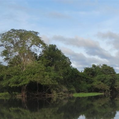
Less known than the South, the Northeast of Brazil (Nordeste) consists of nine states and extends along the north Atlantic coast of the country.
It represents 12% of Brazilian geographical territory and accommodates nearly 25% of the population of the country. The region has an atypical geography and perfectly preserved wild habitats. It is a coastal area composed of white sand beaches bordered by dunes, stretching from Sao Luis in the North to Bahia in the South.
The climate is relatively arid, which explains its desert landscapes, these particular areas are therefore not so resplendent with culture as with the Sun. Nordeste is however, very pleasant in all seasons, which explains the growing tourism craze for this destination.
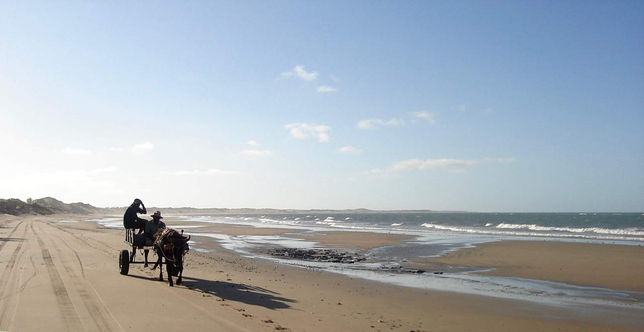
The Northeast Coast, miles of beaches dotted with fishing villages
The most Westerly located state, Maranhão still benefits from the tropical climate of the Amazon rainforest and is in fact, wetter than the other states of Nordeste. With low altitudes and a fairly flat topography, the state has modest reliefs, with about 90% of its area below 300 meters, an area of about 332 000 km2.
Its capital, São Luis, was founded by the French in the seventeenth century, in a few short years it passed to the Dutch, and finally to the Portuguese. This explains the architectural richness of the old town: superb azulejos, cool arcades, churches with baroque pediments, colored tile roofs; everything here is reminiscent of Portuguese culture. Listed as a UNESCO World Heritage Site, it is the largest arrangement of Portuguese colonial architecture in the world. Its population is about 1 200 000 inhabitants.
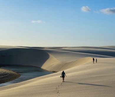
270 km east of São Luis on the Atlantic coast, the natural park of Lençois Maranhenses offers the spectacle of one of the most magnificent natural curiosities of Brazil: it is a desert, spread over an area of 1,550 km2, but a desert different from all others on Earth. It is a vast network of bright-white dunes whose shapes evoke the folds of a piece of fabric unfolding as far as the eye can see, hence the term Lençois (“sheets” in Portuguese). But what distinguishes this desert expanse from all the others is the natural pools of rainwater that form between the dunes, warmed by the burning rays of the sun. Heavenly places to swim in the relaxing silence of the area!
The state of Maranhão also boasts the flagship of Brazilian space technology with the Alcântara launch pad. Established in 1990, this center is owned by the AEB (Agência Espacial Brasileira) and is used for the launching of sounding rockets carrying scientific payloads and performing suborbital flights in the upper atmosphere.
Following alongside, we cross the state of Piauí, located in the arid region of Sertão. Its economic activity is weak and depends almost entirely on livestock breeding. Its coastline is very small, but hosts the delta of its most important river, Rio Parnaíba. A rare geographical configuration found only in 3 places in the world. In South America with Parnaiba in Asia with the Mekong and in Africa with the Nile.
Then comes the state of Ceará. It is wholly owned by the “caatinga”, a semi-arid region of the Northeast of Brazil characterized by a short wet season; limited to 3 or 4 months a year, as well as a high level of biodiversity. Along with Piauí, Ceará is one of the poorest coastal states in Brazil. It is a state with an especially strong tourist attraction, thanks to its fantastic beaches spread over the 775 km of its coastline.
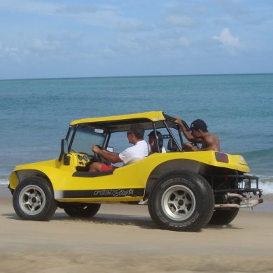
Among the many beaches of Nordeste, one of them “Jericoacoara” is in the “top 10” of the most beautiful beaches in the world. Its calm waters are a delight to bathers and its landscapes are perfect for long hikes, on foot or buggy, as far as the eye can see. Moreover, a string of authentic fishing villages, such as Icarai, Guajiru and Cumbuco, run along the beautiful wild beaches that gently lead to the state capital, Fortaleza, populated by nearly 2,400,000 inhabitants.

Nordeste: trade winds, fine sand, dolphins, turtles and everything in between
In the vicinity of Fortaleza, and continuing down the coast to Natal, capital of the state of Rio Grande Do Norte, the long beaches with mineral scenery are surrounded by Restinga, (the local low vegetation) and are rocked continuously from June to December by winds blowing from the West. Here again, the joys of water sports accommodate the plenitude of remarkable small fishing villages, such as that of Canoa Quebrada in the red land, discovered in the sixties by the directors of the French New Wave. Or that of Pontal de Maceio known for its air of unparalleled purity.
80 km south of Natal, Pipa beach is famous for its natural pools, dense coconut plantations, rugged cliffs and fine white sand. This trendy seaside resort nestling in a paradisiacal setting is also famous for its dolphins and turtles. Returning to Natal to enjoy the charms of the urban nightlife in Brazil, the visitor cannot fail to fly to the small island of Fernando De Noronha, a real ecological jewel of Brazil.
Located 300 km from the coast, Fernando De Noronha is a part of the state of Pernambuco. This small archipelago with a tropical climate combines breathtaking fauna and flora in picturesque scenery, as well as an underwater seabed with unparalleled beauty. The main island is small, 26 km2, and has 2800 inhabitants. The island exists as a complete autarchy thanks to the school, wind turbines, waste reprocessing plant and hospital.
The archipelago is a leading example of environmental conservation (visits are controlled and limited) and has the status of a natural park. It is also on the UNESCO World Heritage List. Whales coming regularly to swim on the surface, or the thousands of birds gathered around this terrestrial Eden make Fernando de Noronha an incomparable place to discover.

Cultural Recife
Further south is the state of Paraiba. Here lies the easternmost point of the Americas, the tip of Seixas, João Pessoa. The regional economy is based mainly on agriculture (sugar cane, pineapple, cassava, maize, beans) and livestock. Industrial production (food, cotton, sugar and spirit) and tourism alongside a thriving lobster fishing industry make up the economy of Paraïba.
South of Paraiba, lie the state of Pernambuco and its capital, Recife. Recife is the oldest capital of Brazil, founded in 1537. Recife is the fifth largest urban agglomeration in Brazil with 3.7 million inhabitants and is the main economic and tourist center of the region. It takes its name from the reefs on which the waves of the Atlantic Ocean break. This is a city focused on culture and tourism, but also industry and port activity thanks to its port of Suape.
Bordering Recife to the north, Olinda bears witness to a rich Portuguese past: from the 16th century, it became one of the most prosperous cities in Nordeste thanks to its sugar industry. As with other Brazilian cities, its cultural and architectural growth linked to the exploitation of sugar cane attracted artists from all walks of life. They created a city centre of richness and splendour that broke through the barriers of time. Nicknamed the “tropical Venice” because of a large number of bridges and canals, the city of Recife has magnificent monuments of colonial architecture and boasts a world-famous carnival.
The descent to the south continues with the states of Alagoas and Sergipe (the smallest state of Brazil), both known for long and alluring beaches suitable for swimming, sunbathing and great walks, ending in the state of Bahia and its capital, Salvador.
Bahia, the Afro-Brazilian expanse in the south of Nordeste
Bahia is one of Brazil’s fourth largest states by population with 13,800,000 inhabitants in 2005 and fifth by area with 564,273 km2. Bahia’s economy is agrarian, based on sugar cane, cassava, corn, coconut, cocoa, but also its world famous coffee. The state is also developing an important industrial activity in the fields of chemistry, computer science, automotive, petrochemicals and mining. There is also a large petrochemical cluster and an industrial complex belonging to the Ford Motor Company in Camaçari, near Salvador.
Salvador de Bahia, which was the first capital of Brazil before being replaced by Rio in the seventeenth century, then Brasilia in 1960, has preserved many outstanding examples of Renaissance architecture. It is one of the largest cities in Brazil with 3,200,000 inhabitants. Salvador de Bahia is also famous for her carnival on some of the most popular streets in the world.
One of the peculiarities of Salvador is that it is the main source of Afro-Brazilian culture and the anchor of the religion Candomblé, syncretism born of a curious mixture of Catholicism imported by the Portuguese colonizers and African beliefs of slaves brought back from Africa. Reminiscent of the religious rites of yesteryear, a colorful celebration with music takes place every year at the Bonfim Church, the Festa do Bonfim, which can be a great alternative to the carnival for those who want to go out off the beaten track.
Salvador combines both the pleasures of seaside, thanks to its beaches, its Bay of All Saints (Bahia de todos os Santos) and the charm of the island of Itaparica with its beautiful fishing villages. Furthermore, it boasts the historical discovery in the district of Pelourinho classified in the world patrimony of UNESCO, and finally an exquisite nightlife, intense and feverish especially during the carnival period.
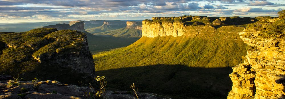
Besides the attractions of the sea, Bahia offers a break in a real “green jewel”, the Chapada Diamantina, which contrasts sharply with the semi-arid landscapes of the interior and the tropical beaches lined with coconut trees.
Located inland, about 400 km from the regional capital, Chapada Diamantina is a wild and unspoiled place that is flown to out of Salvador. Various ecosystems, ranging from savannah / bush to tropical forest, cover the 1520km² of the national park. The relief is composed of high plateaus, “chapada” features, and valleys interspersed with hundreds of streams of crystalline purity, forming networks of waterfalls and other basins. An ideal setting offering visitors the opportunity to refresh easily throughout their excursions.
The Chapada is home to a variety of wild species that benefit from the large number of biotopes (savannah, dry forest, rain forest) surrounded by the deeply undulating mountainous terrain between the local canyons called Chapadas. These geological formations are characterized by their appearance; truncated mountains with rather steep walls and whose peaks consist of large rocky plateaus covered with low vegetation. Between them, there are narrow winding valleys which shelter denser forests and in the most shady, very humid areas are caves with turquoise lakes. Between mountains with tropical vegetation and hundreds of animals, waterfalls, and underground chasms, a stay at Chapada Diamantina irremediably enriches the library of memories.
